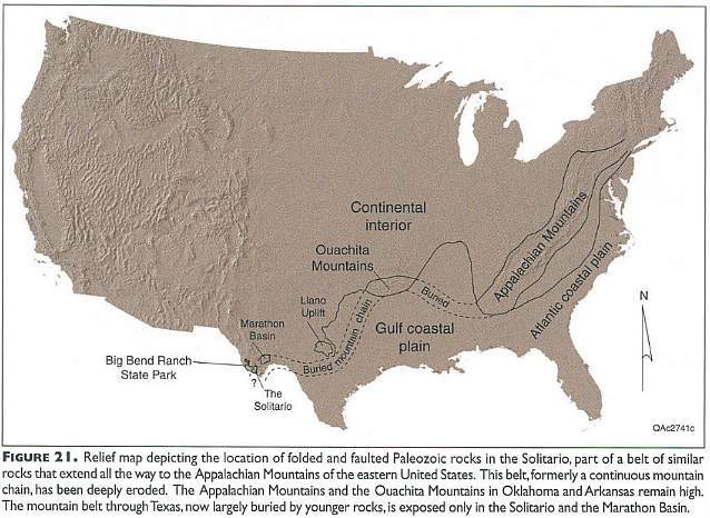
Big Bend National Park
and
Big Bend Ranch State Park
Texas
Figures and graphs from Henry (1998), Maxwell (2001), and Big Bend National Park Service brochure (2002).
Location of Big Bend region along suture zone between North American plate and island arc systems, South American plate, and African Plate during formation of Pangea.
Above figure from Henry, 1998.
Crustal thinning and stretching above a descending oceanic
plate formed
Basin and Range Province
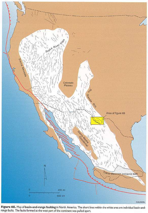
Above figure from Henry, 1998.
Basin and Range faults in the Big Bend Ranch and Big Bend areas
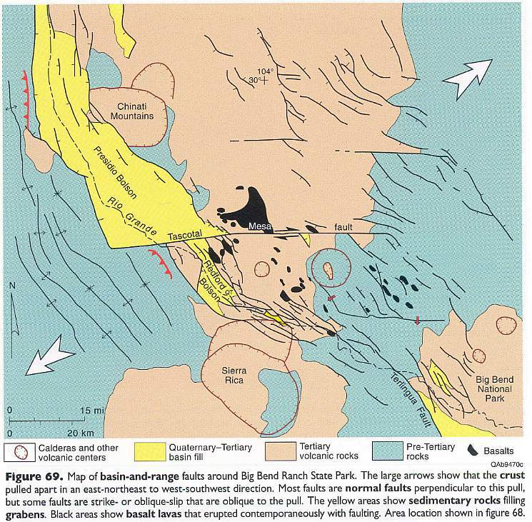
Above figure from Henry, 1998.
Continental Volcanic Arcs along western North America and
Central America
Note how volcanic region falls within Basin and Range Province
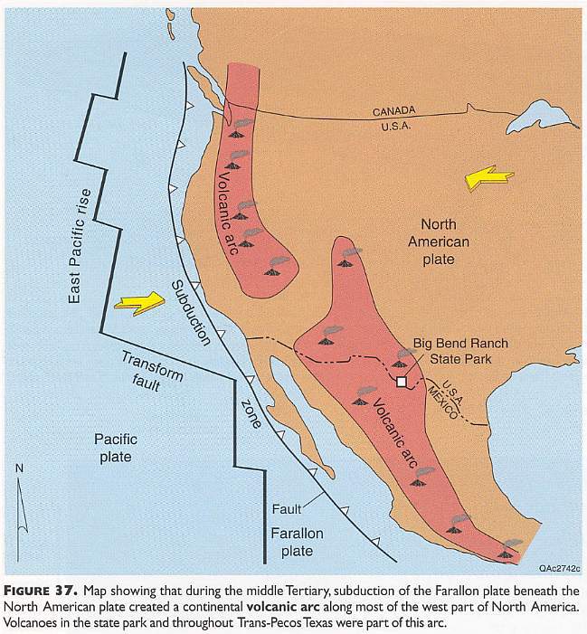
Above figure from Henry, 1998.
Collision between the North American and South American plates
during the formation of Pangea in the late Paleozoic
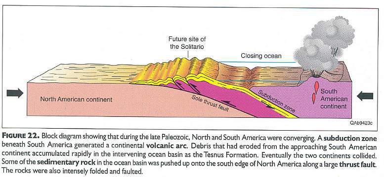
Above figure from Henry, 1998.
Cretaceous formations in the Big Bend Ranch area, and
reconstruction of the
Pacific Continental Shelf
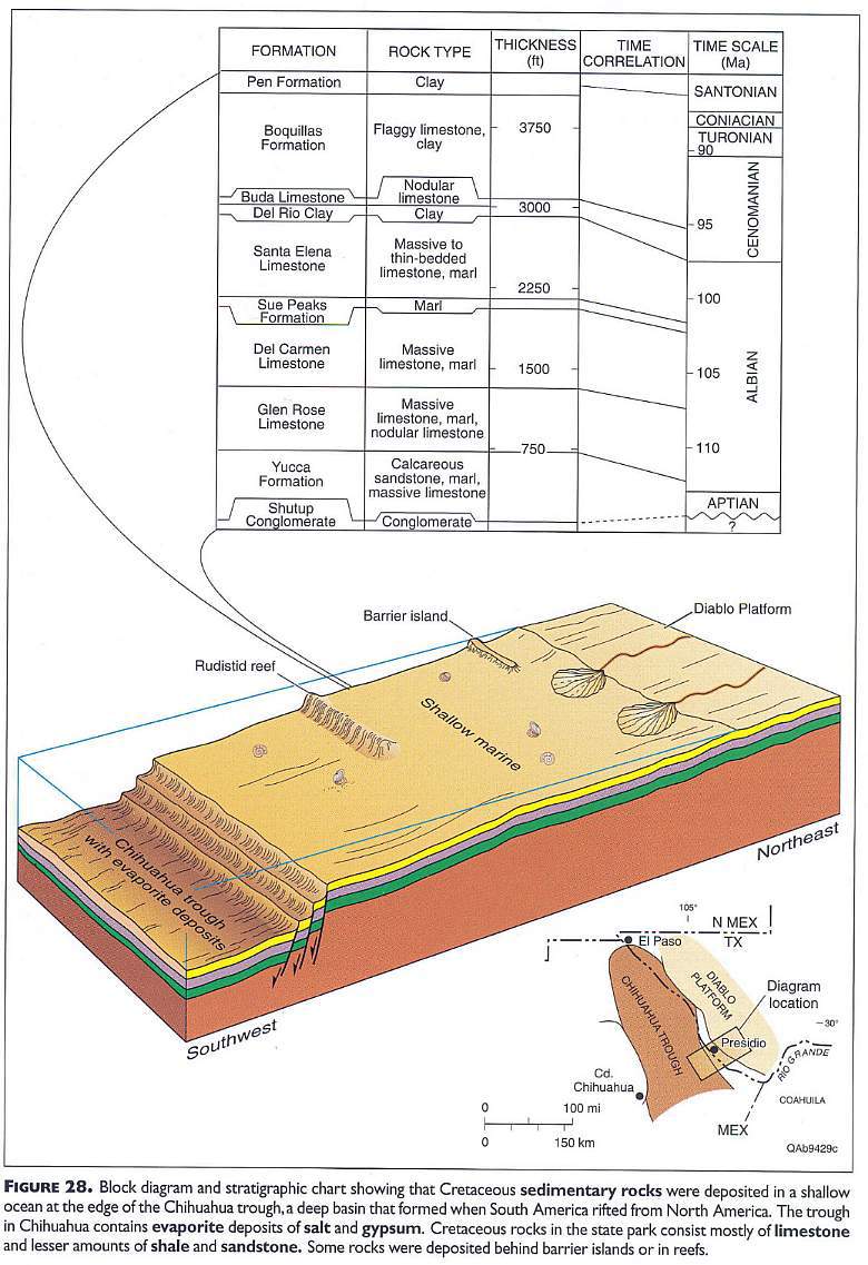
Above figure from Henry, 1998.
Paleozoic to Recent rock strata in the Big Bend National Park
area
color coded for selected photographs below
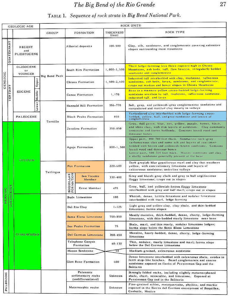
Above figure modified from Maxwell, R.A., 2001 (9th ed.). The Big Bend of the Rio Grande, Guidebook 7, Bureau of Economic Geology, The University of Texas at Austin.
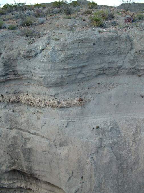
Beige: Gypsiferous Pen Fm. (yellowish; Santonian: Upper Cretaceous) on top of San Vincent Member of Boquillas Fm. (grey part of lower cliff exposure). (photo by B.Cornet)
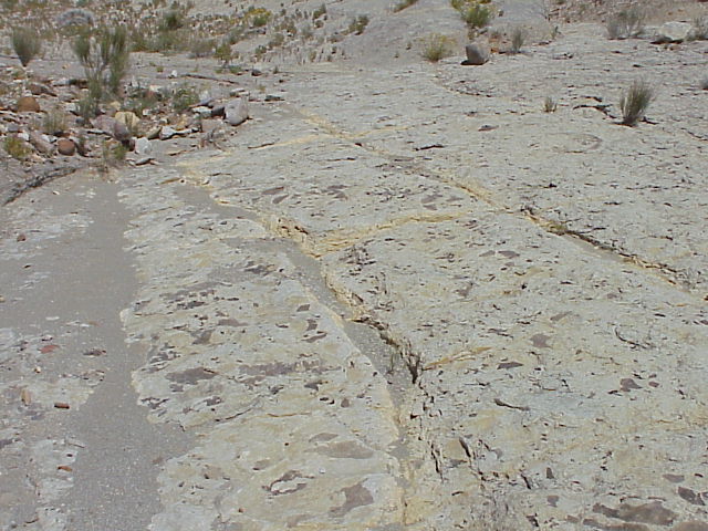
Beige: Twenty feet below top of San Vincent Member showing hundreds of Inoceramus fossils (giant flat oysters). (photo by B.Cornet)
Beige: Dr. Cornet in front of San Vincent Member of the Bosquillas Fm. (Cenomanian to Santonian: Upper Cretaceous) at hot springs along Rio Grande River. (photo by B.Cornet)
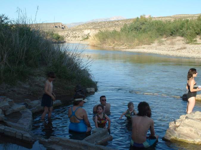
The hot spring on the U.S. side of the Rio Grande River attracts thousands of visitors each year. The water comes out of a natural conduit at 80 degrees Centegrade, and has to be cooled in separate pools for people to bathe safely. Even so, the heat can cause people to pass out if they stay in more than fifteen minutes. It is quite a contrast to have cold rapidly flowing river water next to hot water. The hot spring indicates that a "live" magma chamber exists below this area, similar to what exists at Yellowstone National Park. Mexico begins on the far side of the river - a stone's throw away! (photo by B.Cornet)
Beige: Large Inoceramus oyster from San Vincent Member (near Dog Canyon). (photo by B.Cornet)
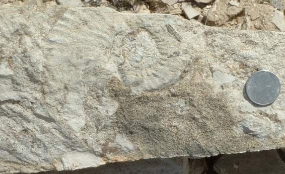
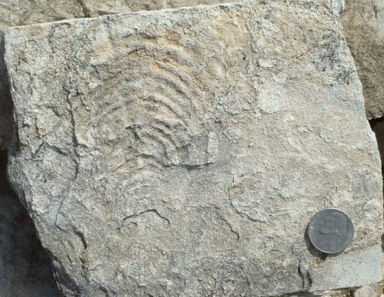
Beige: Coiled ammonite (cephalopod) fossil from San Vincent Member (near Dog Canyon). (photo by B.Cornet)
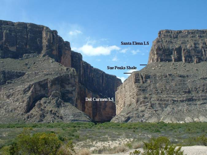
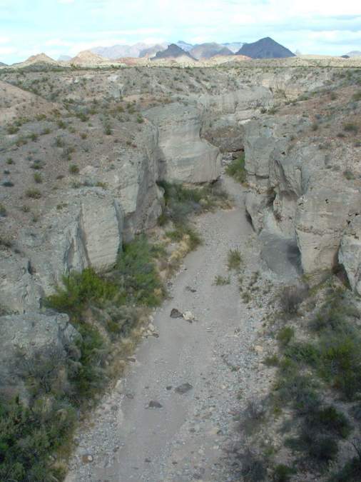
Beige: Middle to late Albian Santa Elena Limestone, Sue Peaks Shale, and Del Carmen Limestone at Santa Elena Canyon along Rio Grande River. (photo by B.Cornet)
A disconformity exists at the Cretaceous-Tertiary boundary
Why is there a disconformity there?
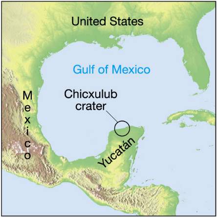
Note the proximity of the Chicxulub crater, the asteroid impact site that created a megatsunami that swept across the lower North American continent and Central America.
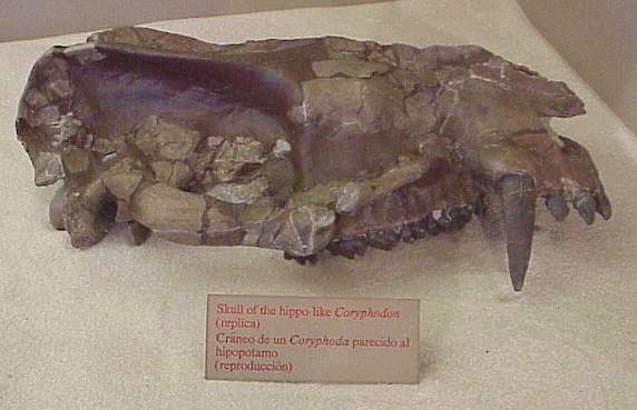
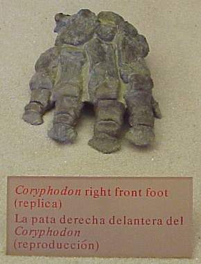
Paleocene floodplain deposits preserve early mammals
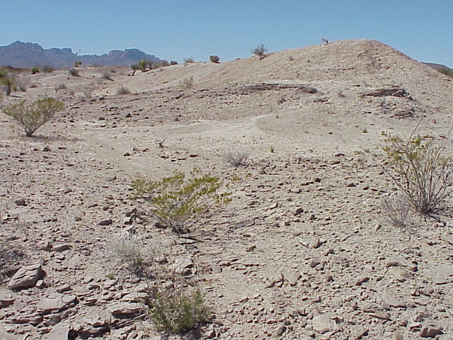
Blue: Grey-brown mudstones and grey channel sandstones of the Black Peaks Formation (Paleocene) have produced numerous fossils of early Tertiary mammals. (photo by B.Cornet)
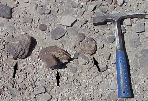
Blue: Coprolites (possible Coryphodon "hippo" patties) can be found scattered on the erosional surface. (photo by B.Cornet)
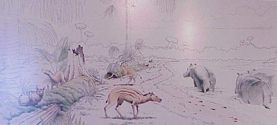
Exhibit at Panther Junction Tourist Center (photos by B.Cornet)
Mammal fossils
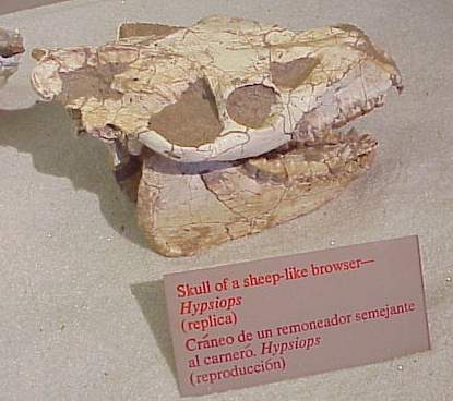
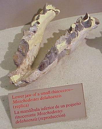
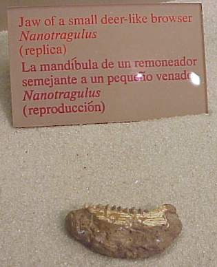
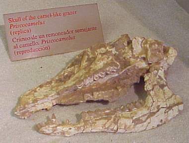
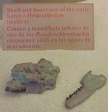
Reptile fossils
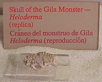
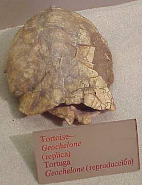
Illustration of volcanism in Continental Volcanic Arc terrane
of
Big Bend Ranch State Park, TX (27-47 mya)
Yellow:
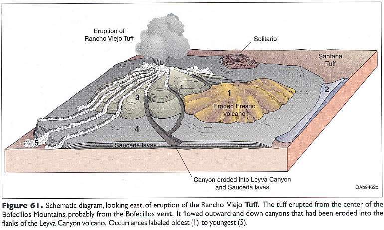
Above figure from Henry, C.D., 1998.
AD: Get free demos for 70-488 braindumps
and 70-462 with 100% guaranteed
success. Our best quality certification ccnp
prepares you well before appearing in the final exams of 642-998 braindumps & LPI .
[11.24.14-17]
Formation of the Solitario caldera during the Oligocene (35 mya)
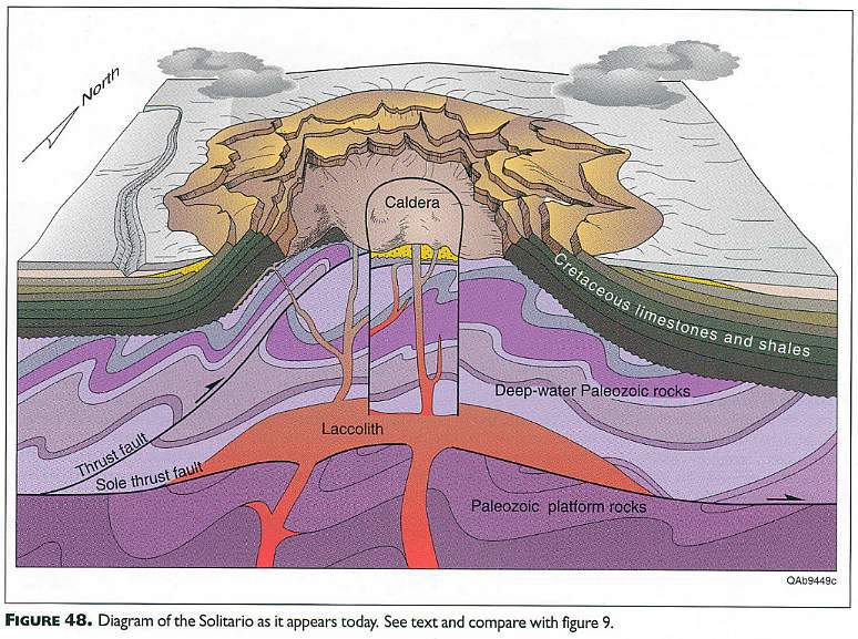
Above figure from Henry, C.D., 1998.
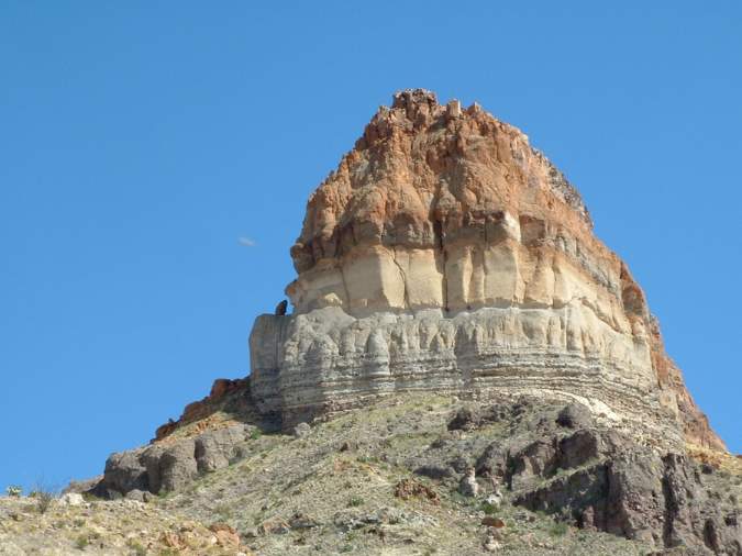
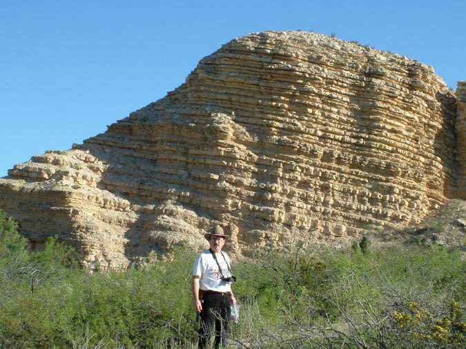
Yellow: Cerro Castellan Mountain (Chisos Formation) containing late Eocene volcanoclastic sequence, BBNP. (photo by B.Cornet)
Yellow: A small intrusion of glassy riebeckite rhyolite about 20 feet high is three-tenths of a mile southwest of Cerro Castellan. Because of the concentric flow structure, this mass has been frequently misinterpreted as a fossil tree. The "knot hole" at one time probably held an inclusion, BBNP. (photo by B.Cornet)
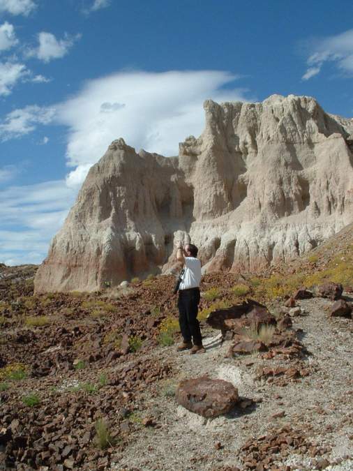
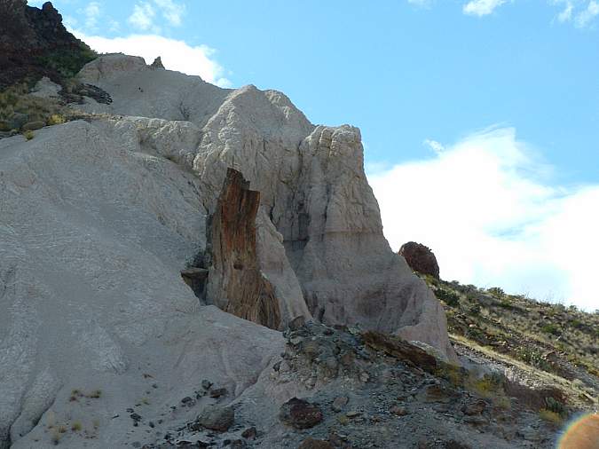
Yellow: Dr. Cornet examining the alternating sequence of rhyolite (brown) and tuff (white) near Cerro Castellan Mountain, BBNP. (photo by B.Cornet)
Yellow: Tuff Canyon containing numerous pyroclastic flow layers, airborn tuff, and volcanic bombs (late Eocene). Chisos Mountains (exposed Oligocene lacoliths) are visible in distance - located near center of Big Bend National Park. (photo by B.Cornet)
Yellow: Close-up of tuff layers with an interbedded stream channel (middle) that has concentrated volcanic bombs and boulders. (photo by B.Cornet)
Cretaceous fossils from the Big Bend National Park
Teal green: Big Bend National Park Service brochure (Division of Interpretation) entitled: Dinosaurs, Pterosaurs, & Crocodiles (2002).
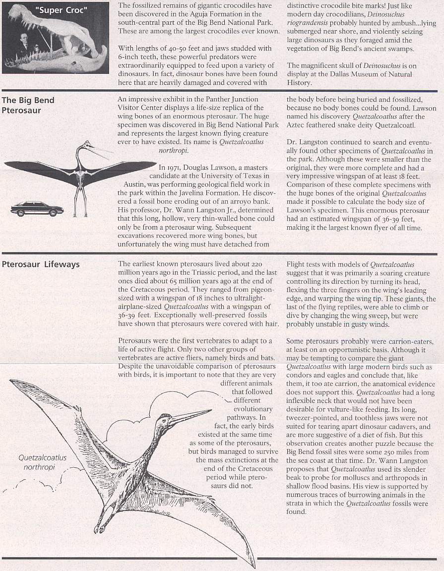
Above from Big Bend National Park Service brochure (2002).
The wing of Quetzalcoatlus
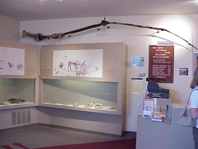
(photo by B.Cornet)
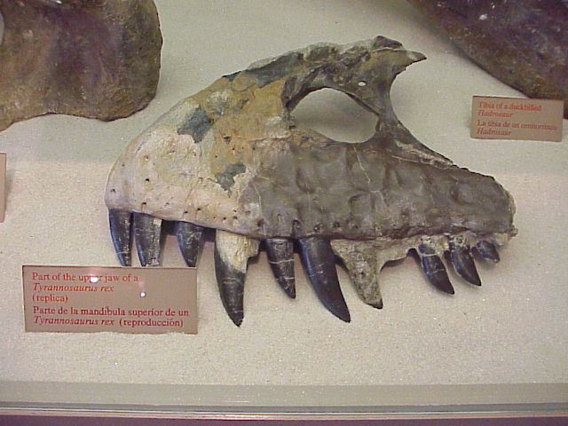
Upper jaw of Tyrannosaurus
(photo by B.Cornet)
Figures 17, 21, 22, 28, 48, 61, 68, and 69 from Henry, C.D., 1998. Geology of Big Bend Ranch State Park, Texas, Bureau of Economic Geology, The University of Texas at Austin.
Web page by Bruce Cornet, Ph.D., El Paso
Community College.
Web page first created on 26 March 2005; modified on 11/26/2014.