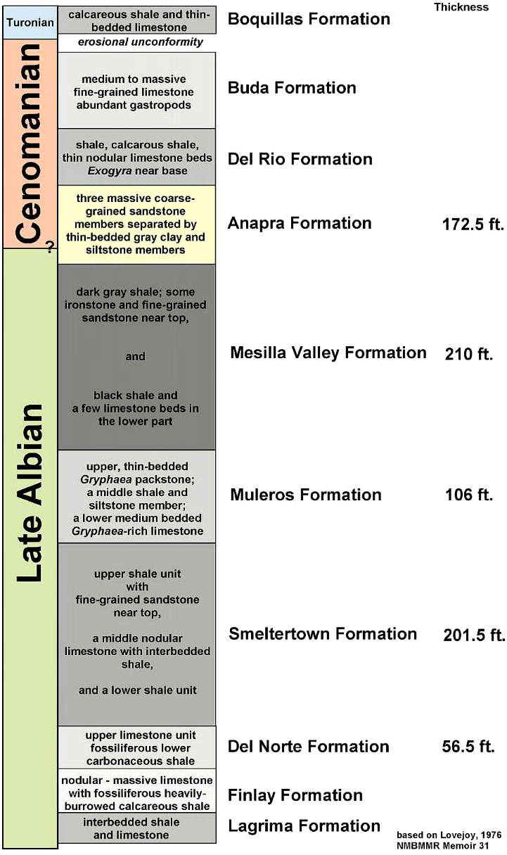
Albian-Cenomanian Stratigraphy and Paleontology,
Cerro de Cristo Rey, New Mexico
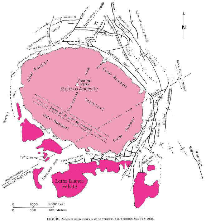
Figure from Lovejoy, 1976.
Figure modified from UTEP.
Figure modified from Lovejoy, 1976.
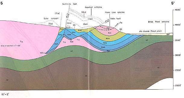
Figure from Lovejoy, 1976.
Above: Figure from Lovejoy, 1976.
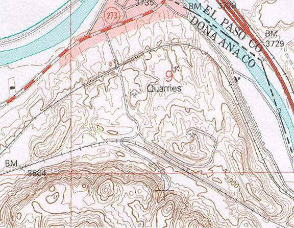
Topographic Map of Old Jobe Quarry on North Side of Cristo Rey
North Side of Cristo Rey
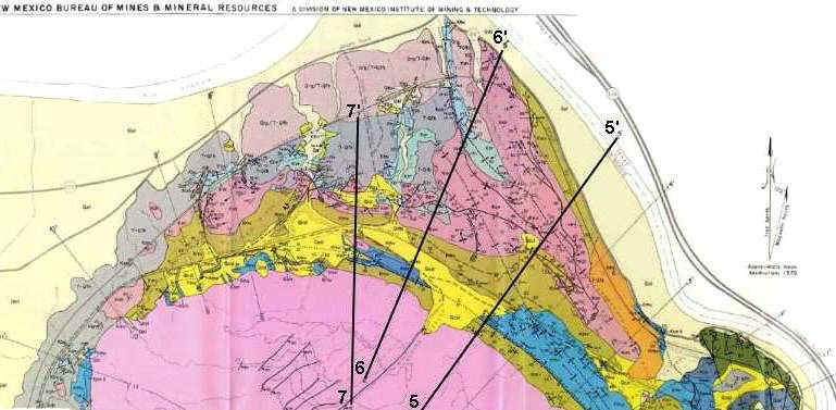
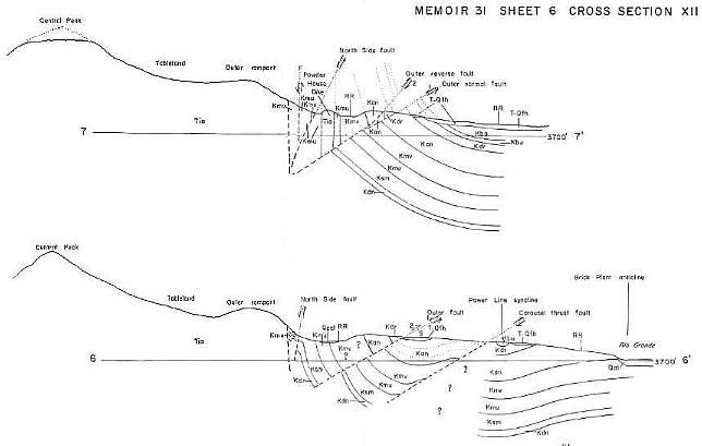
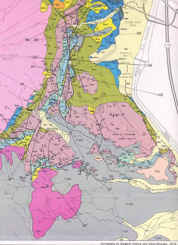
Above: Figure from Lovejoy, 1976, showing highlighted cross sections illustrated below.
Above: Figure from Lovejoy, 1976.
Above: Figure from Lovejoy, 1976.
East Side of Cristo Rey
Above: Figure from Lovejoy, 1976.
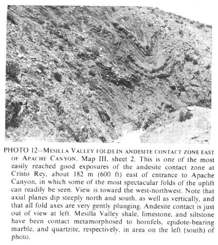
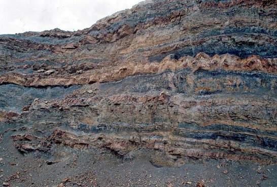
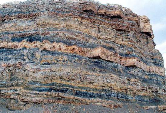
Mesilla Valley Folds
Recent Color Image of Same Folds
Above: Image from UTEP October 2004 fieldtrip.
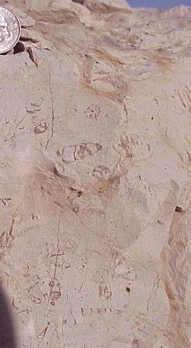
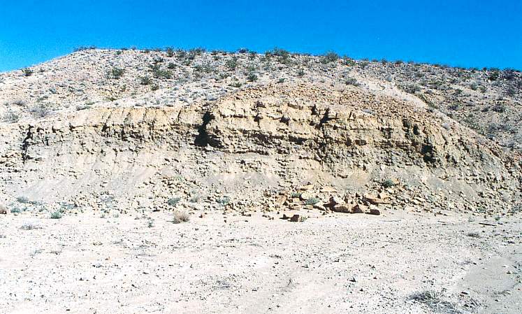
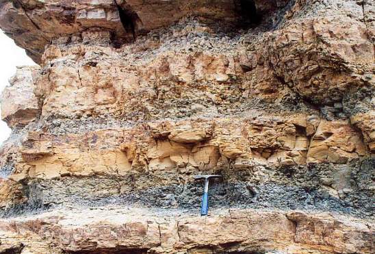
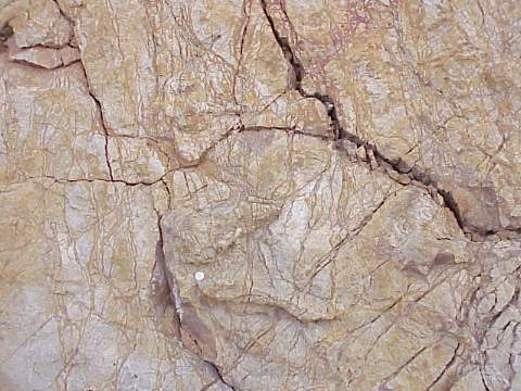
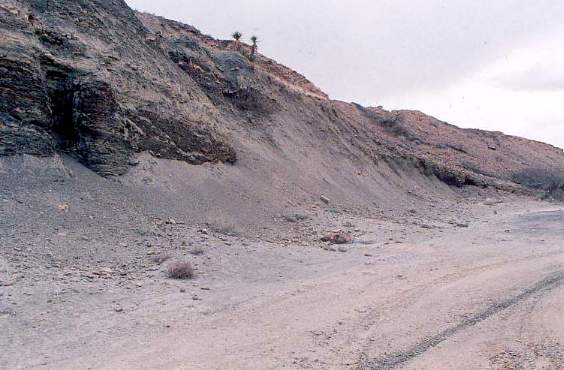
The Buda Formation (Buda limestone) is the youngest formation exposed on the north side of the quarry.
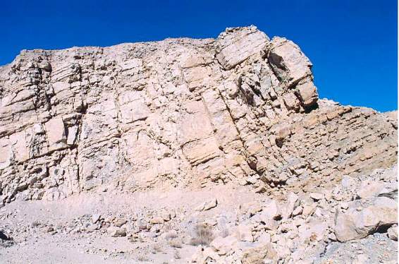
The Buda consists of thickly-bedded gray limestone containing abundant marine invertebrate fossils: Turetella is one of the most easily recognizable shells in cross section.
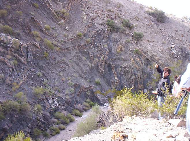
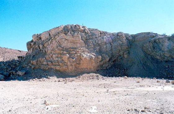
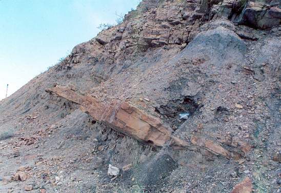
Below: Deformation during the Laramide Orogeny (latest Cretaceous) and during early Tertiary intrusion created these anomalous pinchouts and deformed beds in the Buda limestone.
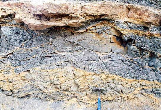
Below the Buda Formation is the Del Rio clay, a formation that can be traced south into the Big Bend area of Texas.
Below: Close-up of Del Rio Clay showing a large Exogyra oyster sticking out of the formation (just above the geology hammer). Exogyra fossils are common in some layers of this formation.
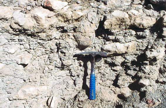
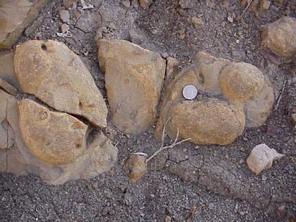
Below: Three specimens of Exogyra from this outcrop (just above and below geology hammer).
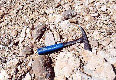
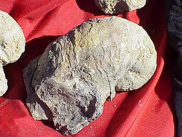
Below: Close-up of a large Exogyra oyster.
Below: Contact between Del Rio Clay and underlying Anapra Sandstone.
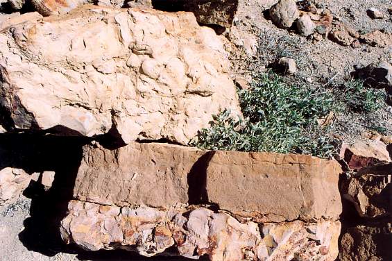
Below: Anapra sandstone, with overlying Del Rio clay in the background.
(image removed)
Below: Series of images of Anapra Formation (deltaic progradation from the northwest).
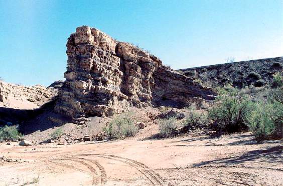
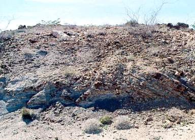
Above: Distant shot of exposures of Anapra sandstone on northeast side of Cerro de Cristo Rey.
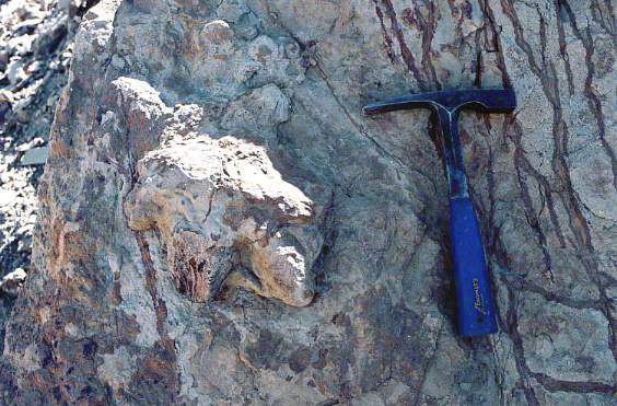
Above: A bedding plane within Anapra sandstone that contains numerous dinosaur tracks and trackways. This surface is called "dinoturbation" by local geologists. White splotches are failed attempts to cast some prints with plaster.
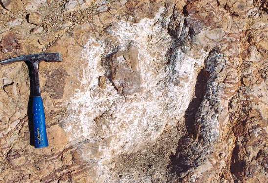
Above: Example of a three-toed track of a carnosaur.
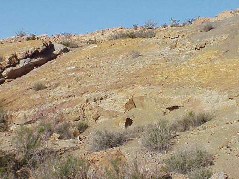
Close-ups of the Anapra Formation
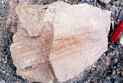
Below: Close-up of cross bedding in Anapra sandstone.
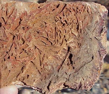
Below: Casts of wood (fragments of stems and twigs) within Anapra sandstone.
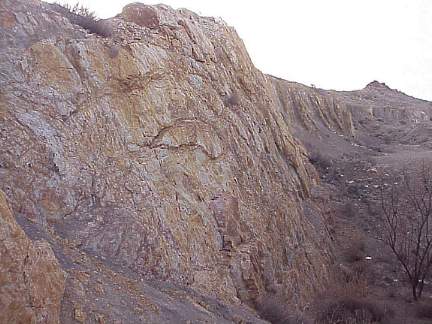
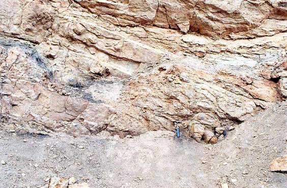
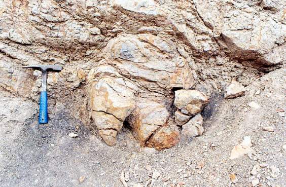
Folded Anapra Formation
Folding here occurred during the Laramide Orogeny (latest Cretaceous-earliest Tertiary).
Below: Highly deformed Anapra sandstone containing dinosaur footprints. Cerre de Cristo Rey laccolith to the left.
Below: Two bird-like carnosaur tracks exposed as reverse positive prints on the outcrop above. Can you spot them?
Below: Can you spot the dinosaur track in the cliff face of Anapra sandstone with interbedded dark gray clayey siltstone layers?
Below: Here's a close-up of the "Eubrontes" footprint
Above: Ankylosaur track in Anapra sandstone.
The Masilla Valley Formation Lies Below the Anapra
Above: Mesilla Valley Fm. transitioning to Anapra sandstone at top of exposure.
Above: Closer look at Mesilla Valley Fm. episodically transitioning upwards to Anapra sandstone as a deltaic lobe prograded out into a shallow sea.
Above: Concretions are common in some layers of the Mesilla Valley Fm, which is dominated by dark gray carbonaceous shales containing abundant organic detritus and palynomorphs.
The Muleros Formation
Beneath the Mesilla Valley Formation is a carbonate bank facies (Muleros Fm.) representing deposition in deeper water further from a clastic source (that which was responsible for the dominance of clay and silt in the Messila Valley shales.
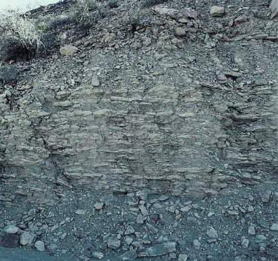
Above: Alternating limestone layers and clayey limestone beds containing numerous invertebrate fossils.
This page was first created by Bruce Cornet on 16 April 2005.
This page was modified on 04/30/2009.