Permian Back-Lagoon Island and Reef
Exposed in Highway Outcrop
East of El Paso, Texas
Table of Contents
Introduction
Geologic Map
Island Exposure
Rock Images
Fossils
A fossiliferous carbonate bank facies with intermittent reef development dominates the Diablo Platform just east of El Paso, TX, in the Hueco Mountains (El Paso and Hudspeth counties).
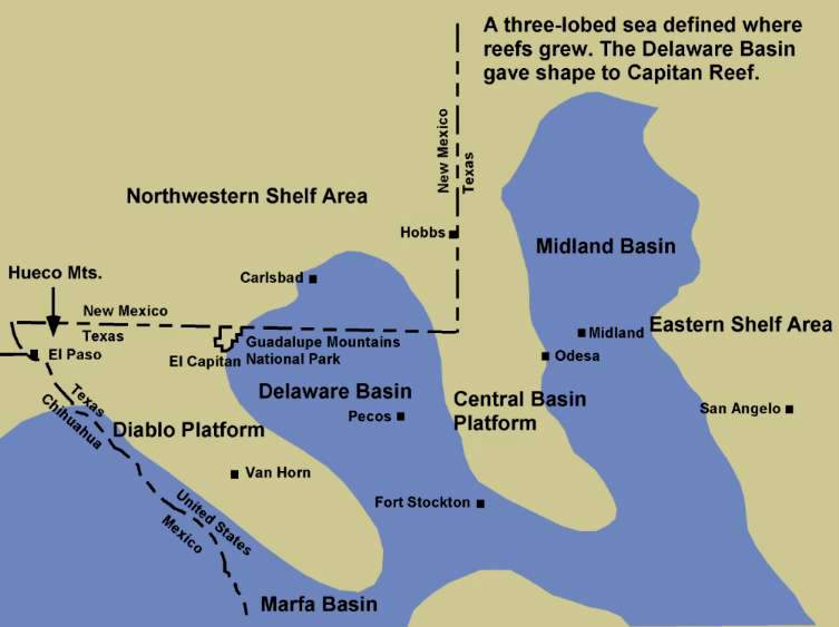
Fluctuations in sea level caused the alternation of depositional environments to form banded limestone units, which are now exposed throughout the area around Hueco Tanks State Park.
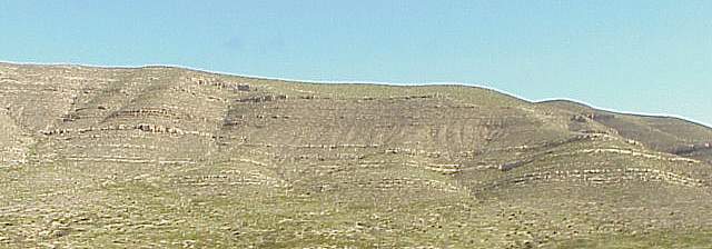
Hueco Limestone exposed along the Pow Wow Canyon walls. While most of the limestone beds contain chert nodules, fossil shells, crinoid stems, and fusulinid foraminifera tend to be more concentrated in certain layers (interpreted as shallower water). Outcrop exposures of the Early Permain (Wolfcamp) Hueco Limestone occur along Route 62/180 in Pow Wow Canyon.
Map showing location of outcrops:
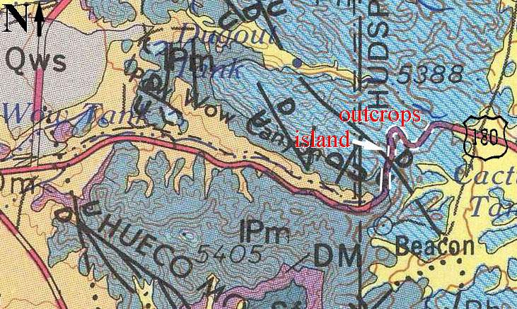
Geologic Atlas of Texas, Van Horn-El Paso Sheet (Revised 1983). Highway outcrops shown as white lines along Rte. 62/180.
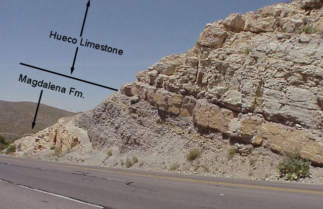
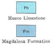
Above: Outcrop of basal Hueco Limestone (Ph) on top of basal Permain Magdalena Formation (IPm; interbedded limestones and shales).
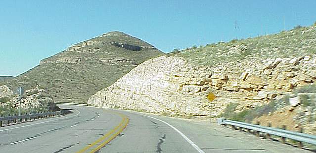
Above: Hueco Limestone outcrop along Rte. 62/180 (looking west). Fossiliferous limestone beds are present in the outcrop to the right, along with a pull-off and small parking area.
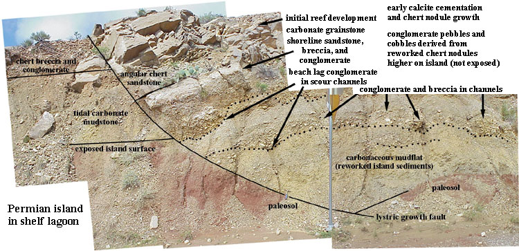
One outcrop reveals local uplift and deformation during carbonate deposition with the development of an island facies: Red soil zone, carbonaceous mudflat with conglomerate lag deposits in scour channels (derived from erosion of the island), overlain by pebble and sand beaches (now seen as conglomerate, breccia, and angular coarse sandstone), then by a reef that grew thicker towards the east (right). A lystric (shallowing with depth) growth fault is also present in the outcrop to the left, indicating that the island probably formed through uplift and extension of underlying carbonate deposits. The pebbles and sand are mostly derived from reworked chert nodules in the underlying deposits, which were exposed higher on the island (not visible).
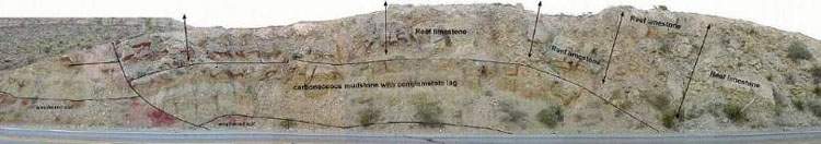
Above: Entire outcrop in one image. Below: Four larger segments of the same image.
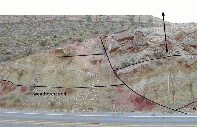
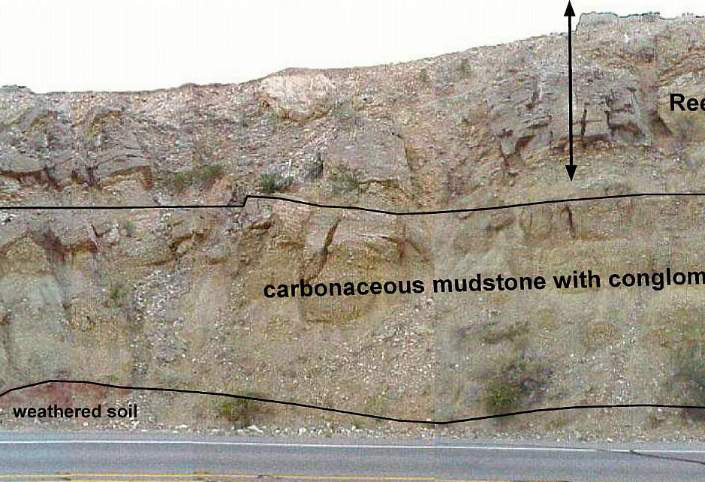
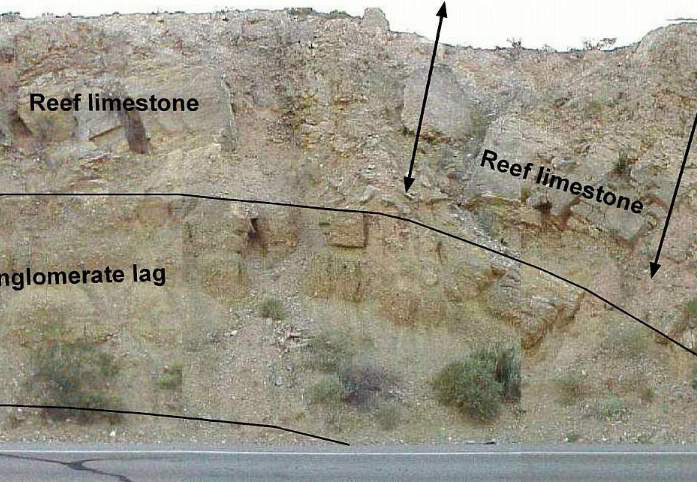
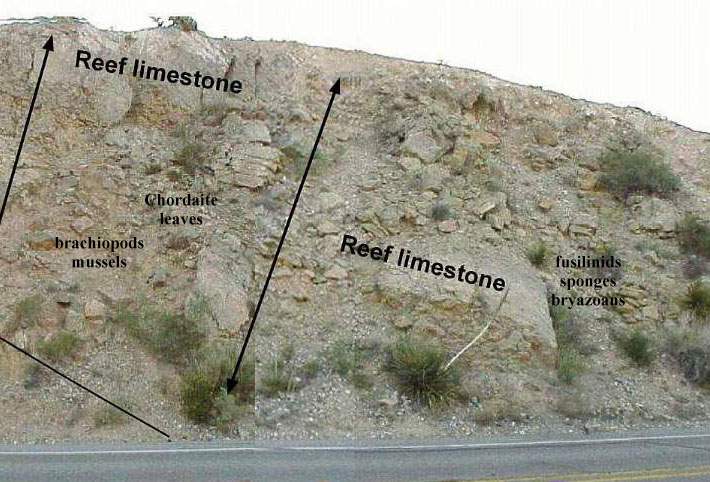
Image of the growth fault with more detailed labeling.
Modern Atoll For Comparison
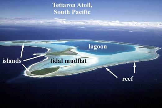
Above: Tetiaroa Atoll from the South Pacific shown for comparison of facies relationships.
Shoreline facies sediments on top of and around a lagoonal island, hundreds of miles from a passive continental slope (e.g. Guadalupe El Capitan Reef) where massive reefs developed.

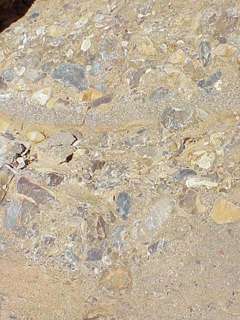
Chert conglomerate and pebbles concentrated in scour channel depressions on a carbonate mud dominated tidal flat environment around the perimeter of a paleo-island.
Above: Interbedded fine and coarse chert sandstone, conglomerate, and breccia - representing shoreline wave-influence deposition and concentration of coarser grain sizes.
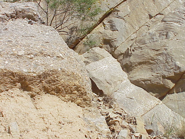
Above: Contrast of lithologies across the lystric growth fault: Chert conglomerate/breccia on the left and carbonate grainstone on the right.
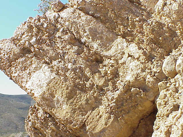
Above: Conglomerate-breccia comprised of chert nodules, reworked and partially rounded, and mixed with chert sand-sized grains on a shoreline.
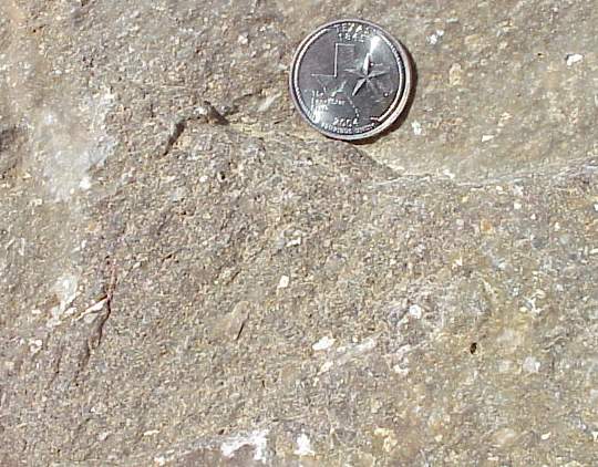
Above: Angular medium-coarse chert (quartz) sandstone in a carbonate matrix.
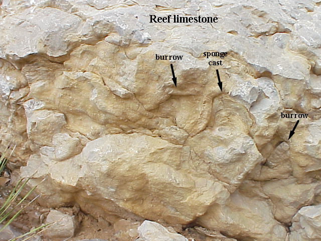
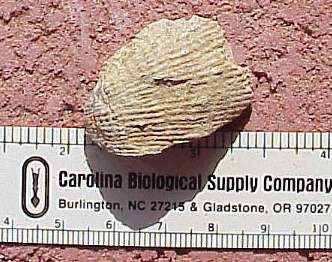
Above: Limestone reef containing casts of burrows and vertical sponges.
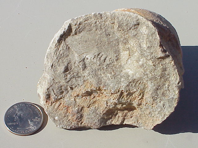
Above: Fragment of a coral contained within a limestone boulder, reworked from underlying reef limestone on the Permian island. This fossil was contained within a boulder that was eroded, rounded, and deposited on the perimeter of the island.
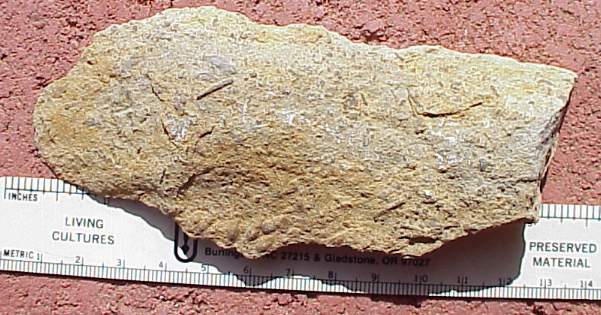
Above: Fragments of bryazoans and football-shaped fusilinids from tidal-influenced carbonate mudstone facies behind the reef.
Above: Half of a Reticulatia brachiopod (upper Pennsylvanian-lower Permian) from tidal-influenced carbonate mudstone facies behind the reef.
Above: Portion of a Myalina mussel (on right: lower Mississippian-upper Permian) from tidal-influenced carbonate mudstone facies behind the reef.
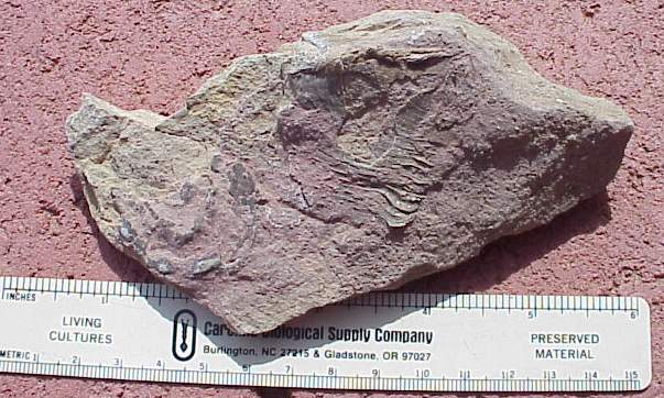
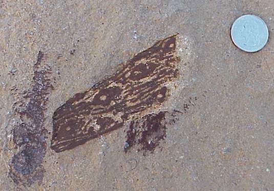
Above: Cordaite gymnosperm leaf from the carbonate reef facies on the right side of the island. The excellent condition of this fossil implies that it was not transported far and came from a plant that grew on the island.
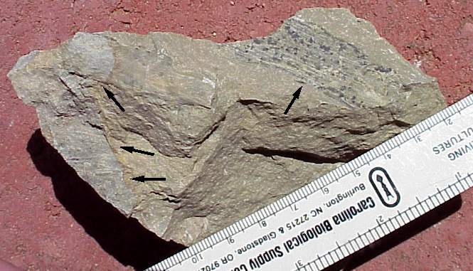
Above: Several overlapping chordaite leaves (arrows) in fine-grained carbonate mudstone, found adjacent to tidal-flat carbonate mudstone facies of island. Carbonaceous material of leaf still present.
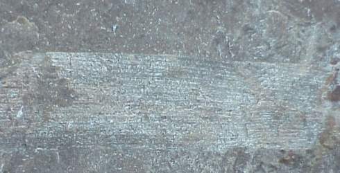
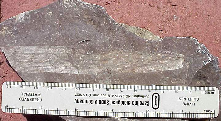
Above: Close-up of the parallel venation in leaf.
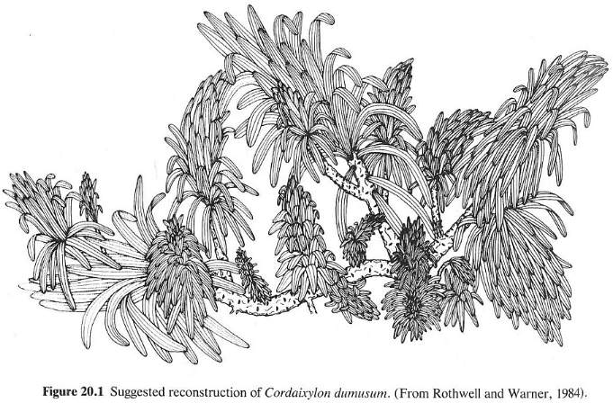
Above figure from T.N. Taylor and E.L. Taylor, 1993, The Biology and Evolution of Fossil Plants, Prentice Hall: 660.
Stigmaria root (of Sigillaria, an arborescent lycopod) from a fine sandstone facies of the upper Pennsylvanian Magdalena Formation. Found in a quarry at mouth of Pow Wow Canyon north of Montana Avenue (62/180). Sigillaria grew in tidally-influenced swamps along coastlines.
Web page by Bruce Cornet, Ph.D., El Paso
Community College.
Web page first created in September 2004; modified on 04/30/2005.