Permian Reefs and Carbonate Complexes,
West Texas
Table of Contents
Geologic History
Permian Carbonate Facies
Missing Time
Permian Basins
Permian Reef Life
Geologic map
More Permian fossils
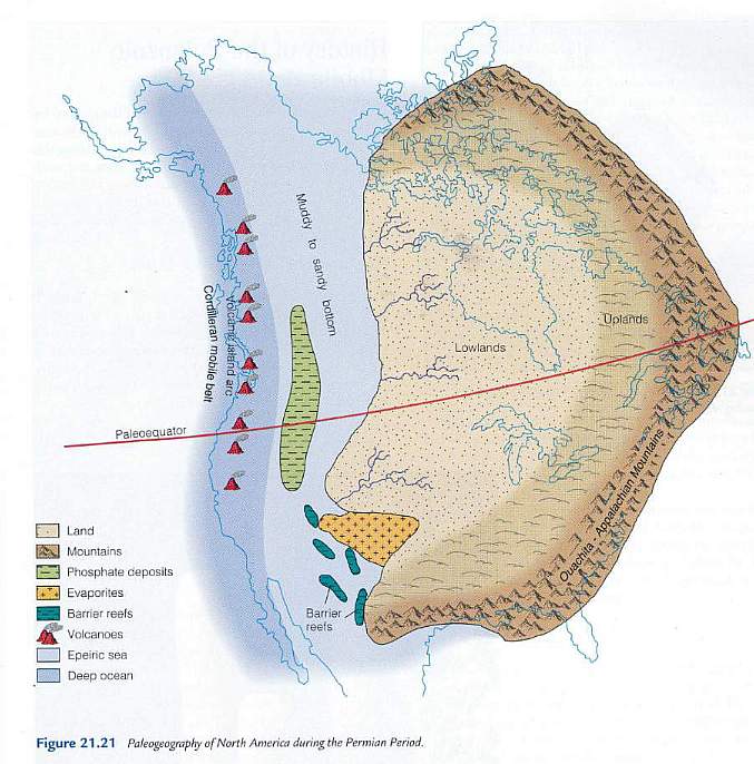
During the early-middle Permain the supercontinent of Pangea had not completely formed. The North American plate was moving towards the east and beginning to collide with the African and Eurasian plates along an active subduction zone. To the west of that subduction zone the Ouichita and Appalachian mountains were forming, and contained numerous volcanic centers along a continental volcanic arc. The western side of the North American plate was the location of a passive continental margin - much like the one that exists today along the East Coast of North America. To the west of that passive margin was a volcanic island arc marking the location of a much older convergent/subduction area between a mid-Pacific spreading center and the continental plate. Along the tropical southwestern portion of the North American plate were linear reef complexes that developed at several seaward edges of the continental shelf, and extensive back reef lagoons dotted with small islands.
Above: Figure 21.21 above from The Changing Earth, Exploring Geology and Evolution (Third Edition: 2001) by James S. Monroe and Reed Wicander.
Permian exposures to the east of El Paso are mostly of Early Permian (Cisuralian and Guadalupe) epochs (268 million years to 300 million years ago).
| http://www.palaeos.com/Paleozoic/Permian/Cisuralian.html | ||||
| Period | Epoch | Age | When began |
Duration |
| Permian | Guadalupian (Middle Permain) |
Roadian | 270.6 | 2.6 |
| Cisuralian (=
Wolfcamp and Leonard) (early Permian) |
Kungurian | 275.6 | 5.0 | |
| Artinskian | 284.4 | 8.8 | ||
| Sakmarian | 294.6 | 10.2 | ||
| Asselian | 299.0 | 4.4 | ||
| Carboniferous | Pennsylvanian | Gzhelian | 303.9 | 4.9 |
Permian Carbonate Facies
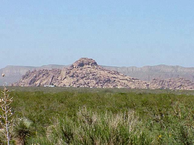
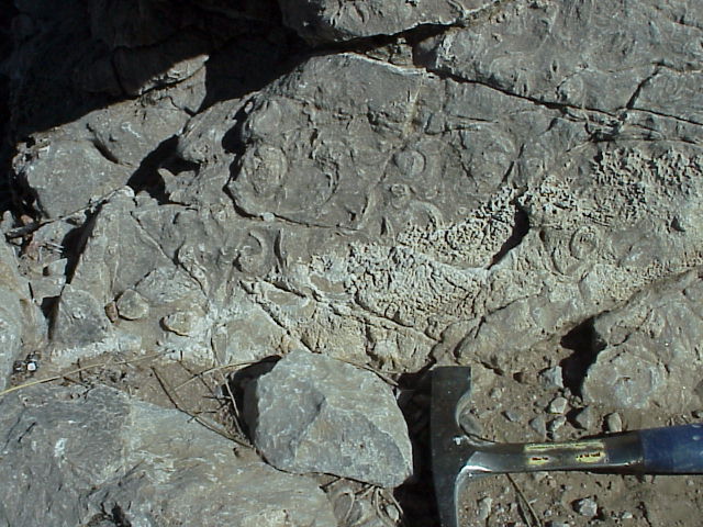
Located near El Paso are the Hueco Mountains, which expose a significant thickness of back-reef carbonate deposits that formed on a Permian continental shelf.
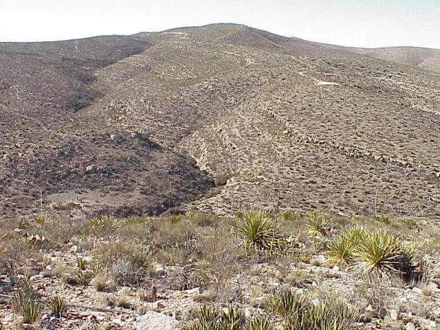
Above: Hueco Mountains south of border check station on Rte. 180/62, western edge of the High Desert (looking south at benches [steps] of more massive carbonate and reef buildup).
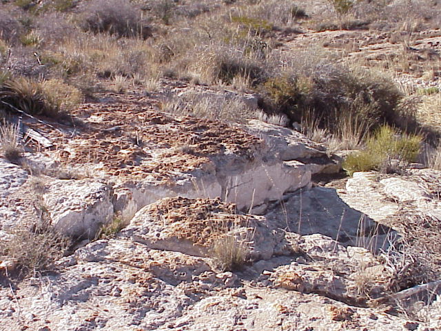
Above: Coral heads (brown) distributed across a depositional surface as they grew.
Above: Close-up of coral heads surrounded by carbonate grainstone.
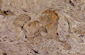
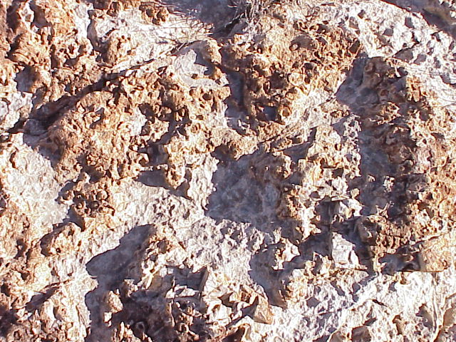
Above: Close-up of coral heads in cross section.
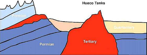
It is within these fossiliferous limestone sequences that igneous intrusions occurred during the Tertiary about 40 million years ago. That intrusion was largely responsible for the uplift, followed by erosion, and exposure of the Permian lagoon deposits as we see them today in the Hueco Mountains and foothills to their west.
Compressional folding and thrust faulting along the western side of the North American plate (when Pangea began to break apart during the Late Triassic and Early Jurassic) resulted in regional uplift and erosion/nondeposition of Triassic and Jurassic strata. That is why Cretaceous-age rocks sit unconformably upon Permian-age rocks in the southwestern U.S. One has to travel north as far as northern New Mexico, Arizona, and southern Nevada (further away from the edge of the plate) to find rocks of Triassic and Jurassic age preserved.
Above: Hueco Tanks State Park showing Tertiary pluton in the foreground with Permian carbonates and igneous sill exposed in the Hueco Mountains (background). Below: Cross section showing how erosion has exposed the Tertiary pluton and sill.
Below: Geologic map for the Hueco Tanks area east of El Paso, TX. Click on map for map index key with geologic formations and ages. HM = location of Hueco Mountains photograph above; HT = location of Hueco Tanks intrusion photograph above.
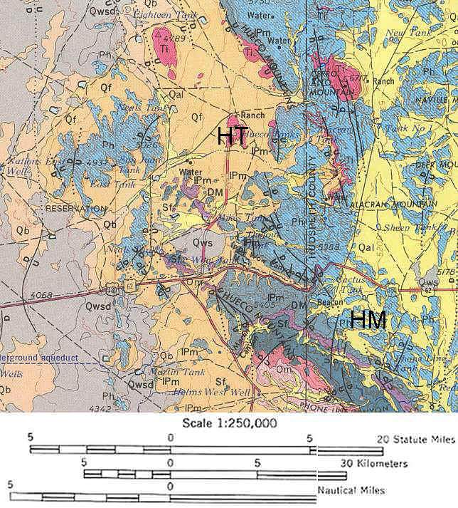
Click on map for map index key with geologic formations and ages. Pink represents Tertiary intrusions.
Permian Basins
of the Southwestern United States and Mexico
Three Permian basins formed along the continental shelf: The Midland Basin to the east, the Delaware Basin in the middle, and the Marfa Basin to the west. They divided the sea floor into three deep areas separated by the Diablo and Central Basin platforms. http://www.palaeos.com/Paleozoic/Permian/Capitanian.html
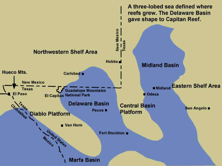
Above: Permian shelf complexes for the Diablo Platform, Texas.
The actual reef complexes formed at the edge of the continental shelf rather than back on the shelf due to an abundance of nutrients that flowed up from the continental rise and slope, upon which the filter-feeding reef organisms fed. Behind the reef complex a shallow carbonate platform existed beneath an extensive lagoon. Around small islands and near the paleoshoreline reefs also developed where wave action and water currents brought plankton and nutrients to reef builders and inhabitants.
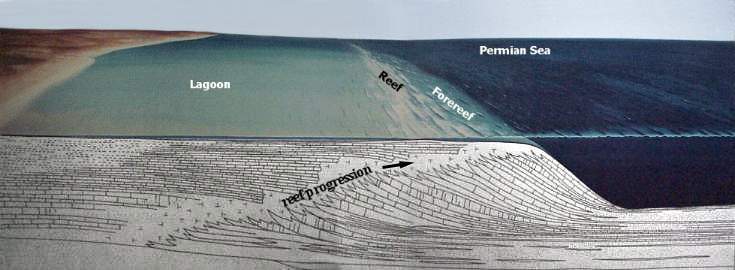
Above: Modified image from Guadalupe Mountains National Park visitor center.
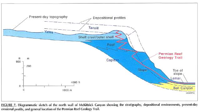
Above: Figure 7 from Guide to the Permian Reef Geology Trail, McKittrick Canyon, Guadalupe Mountains National Park, West Texas (1993) by Don. G. Bebout and Charles Kerans, editors.
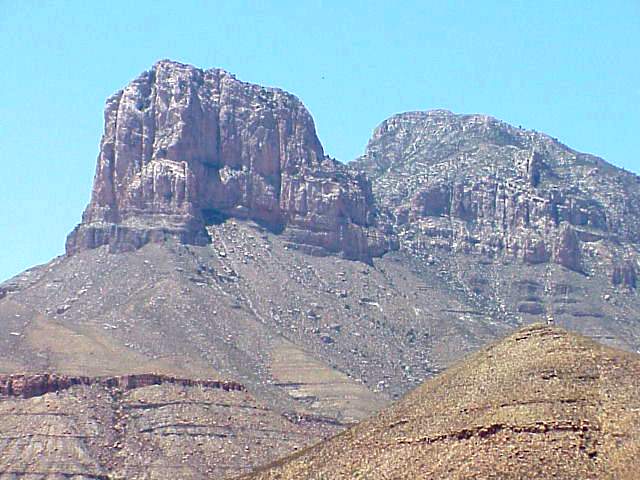
Above: The Capitan Reef at the edge of the paleo-shelf. Photograph by Bruce Cornet.
Permian Reef Life
Reef facies during the Permian were characterized by the following types of organisms: algae (e.g. Collenella and Mizzia), fenestellid bryozoans, ramose bryozoans (e.g. Acanthocladia), fusulinids (e.g. Polydiexodina) and other foraminifera, several types of sponges (e.g. Amblysiphonella, Cystauletes, Girtycoelia, Heliospongia, and Lemonia), Tubiphytes, productid brachiopods, cephalopods, and corals.
http://www.palaeos.com/Paleozoic/Permian/Capitanian.html
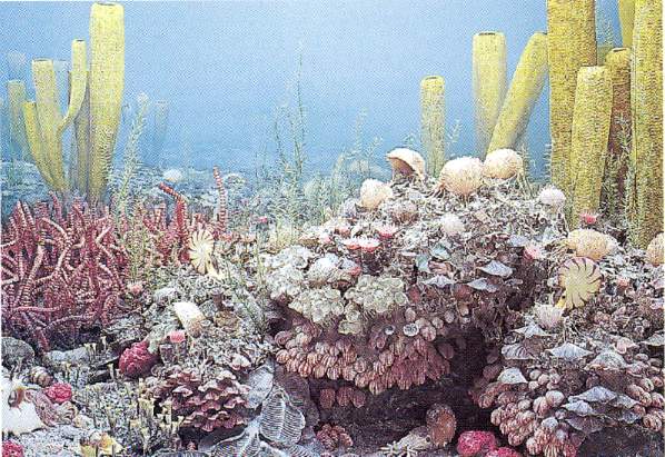
Figure 22.11 above from The Changing Earth, Exploring Geology and Evolution (3rd Edition: 2001) by James S. Monroe and Reed Wicander.
Fossil sponges from the Capitan Reef.
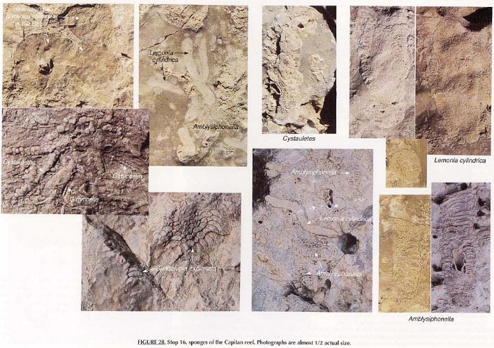
Above: Figure 28 above from Guide to the Permian Reef Geology Trail, McKittrick Canyon, Guadalupe Mountains National Park, West Texas (1993) by Don. G. Bebout and Charles Kerans, editors.
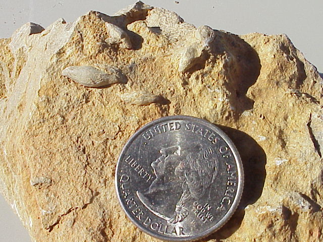
Above: Fusilinids - large rice-grain-shaped foraminifera from the back-reef lagoon area of the West Texas Permian sea.
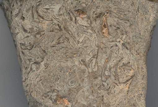
Above: Enlargement of Permian shell hash from west side of Franklin Mountain.
Above: Permian gastropod casts on west side of Franklin Mountain near Astec Cave.
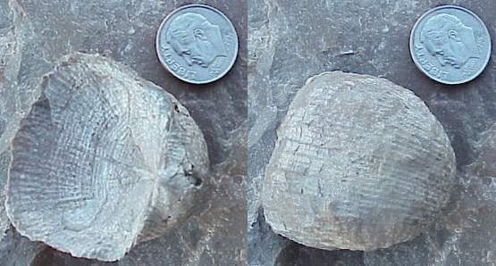
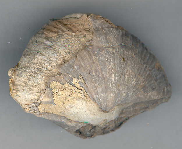
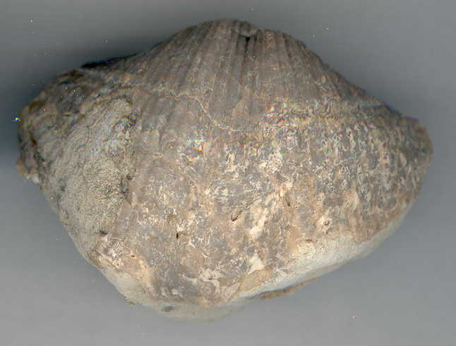
Above: Permian brachiopod, Dictyoclostus.
The back reef complex was populated by different types of bottom dwellers, including common crinoids, very abundant fusulinids (unusually large foraminifera), gastropods, cephalopods, and small corals. Crinoids (sea lilies) were thought to be extinct until they were found living in some of the deeper parts of the ocean. Because they were first known as fossils, living sea lilies are called "living fossils". The diagram below of marine life during late Mississippian Period looked a lot like that living in the back reef lagoon.
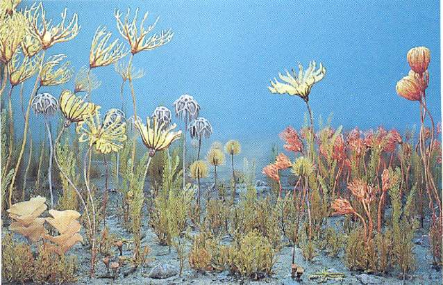
Above: Figure 22.10 bove from The Changing Earth, Exploring Geology and Evolution (3rd Edition: 2001) by James S. Monroe and Reed Wicander.
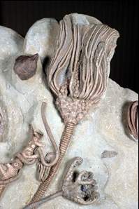
Above: Replacement casts of Paleozoic crinoids, delicately prepared to show exquisite details of feeding tentacles.
Living crinoids.
Feather Star, Cenometra bella
"Feather stars (comatulid crinoids, Class Echinodermata) are prominent and lovely features of coral reefs, although they also occur in higher latitudes. Most conspicuous are the arms, which are festooned by pinnules, which, in turn, bear tube feet that capture small zooplankton by direct interception. The upper right photo shows the cirri, which can grip the substratum. The upper left photo shows the disposition of the pinnules in a plane, which probably corresponds to the location of the feather star (bottom) in open habitats, which are often subjected to unidirectional currents." Source and credit: http://life.bio.sunysb.edu/marinebio/coralreef.html
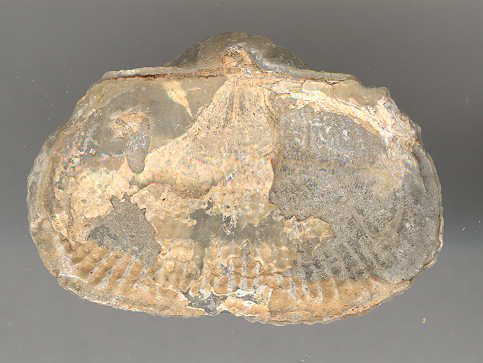
More Permian Fossils
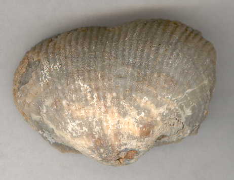
Brachiopod
Brachiopod
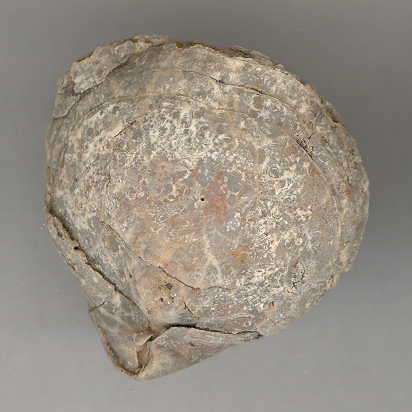
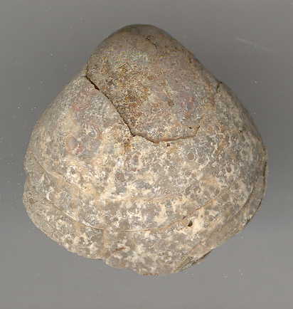
Brachiopod
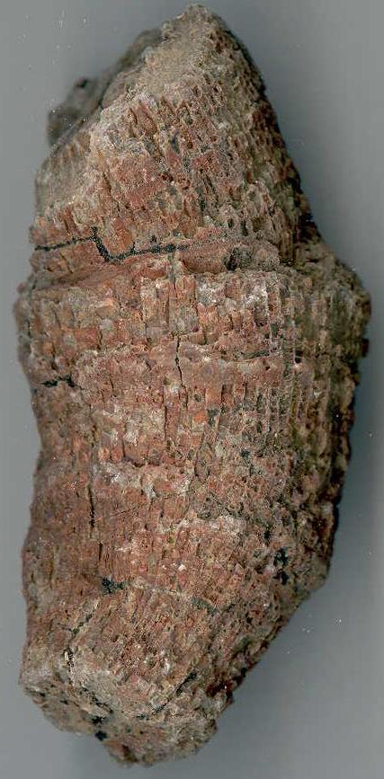
Solitary coral
Inch (top) and centimeter (bottom) scale for above fossils
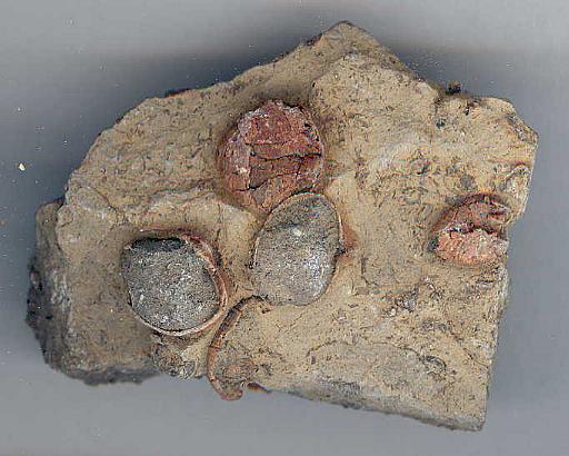
Large fusilinids
Web page by Bruce Cornet, Ph.D., El Paso
Community College.
Web page first created in September 2004; modified on
12/21/2022.