Distribution of UAP Sightings in the Wallkill River and Hudson River Valleys
During the 11 years of field research in these valleys between 1992 and 2003, at least 140 sightings of UAP were documented. Appendix I chronologically lists the dates, times, and witnesses for these sightings, which ended when Cornet was hired by the National Institute for Discovery Science (NIDS) in Las Vegas in January 2004.
https://www.sunstar-solutions.com/AOP/Appendix_I/APPENDIX_Ic.htm
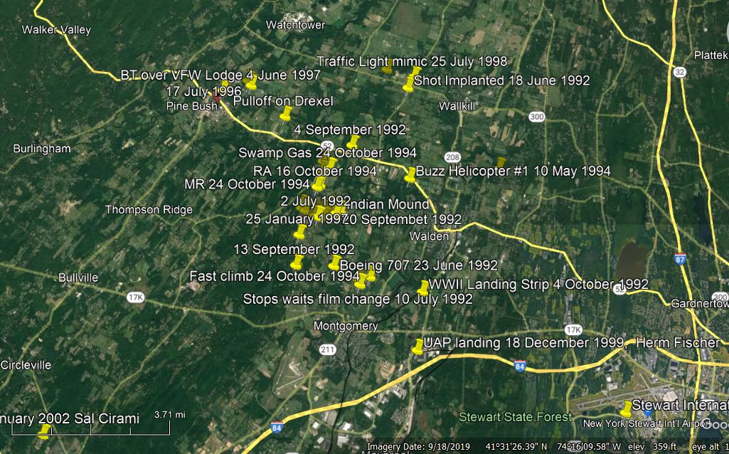
Below are Google maps showing the majority of sightings North and South in these valleys, following the Shawangunk Mountain trend on the Western side of these valleys. The sightings near Salt Point, NY, represent the Northernmost and last sightings for this field study. What should be clear to the reader is just how many UAP were seen, and which intentionally showed up for the witnesses (Cornet and Crystall) again and again over this 11 year period. It was not until years later when all these data were compiled and most published on Cornet's web pages. Preston Dennett published this last sighting in his book, UFOs Over New York in 2008, while Cornet published his comprehensive study in 2019 in his 403 page book, Unconventional Aerial Phenomena in the Hudson and Wallkill River Valley of New York.
https://www.amazon.com/Unconventional-Aerial-Phenomena-Hudson-Wallkill/dp/1075968070
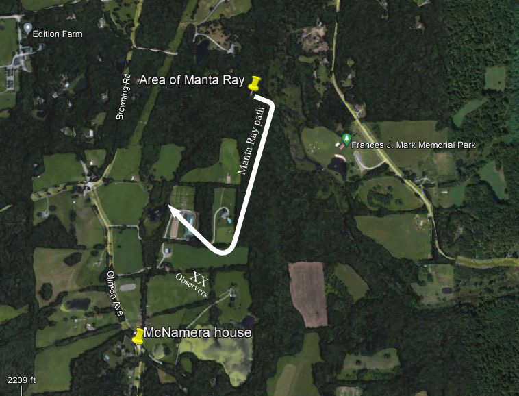
Salt Point, NY, Manta Ray sighting on 20 August 2003.
Map below zoomed out to show Salt Point locality in above map, South to Middletown, NY, sightings at Cornet's condo location in Scotchtown next to Route 211 East, where the Boeing 707 UAP flew over twice on 24 September 1992 after following Cornet home from work. http://www.sunstar-solutions.com/AOP/Boeing/boeing07.htm
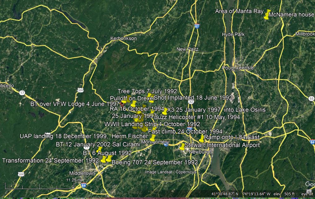
At top of map below is the Traffic Light mimic on 26 July 1998, where a small antigravity UAP tried to make Cornet think that it was a double traffic light at a rural intersection with only stop sights.
http://www.sunstar-solutions.com/AOP/Trafficlight/traffic_light_antigravity_run.htm
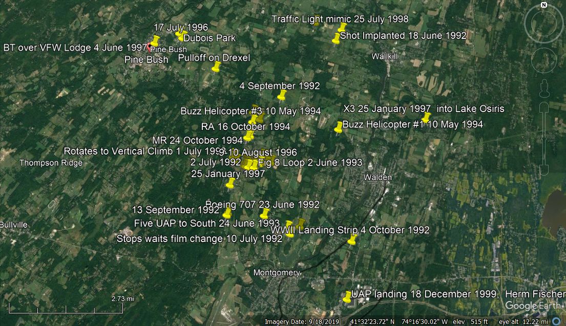
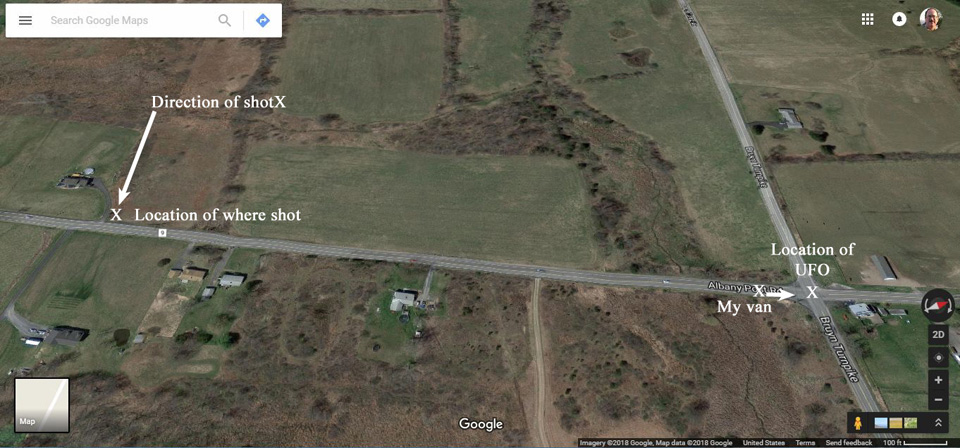
Encounters began and ended near Pine Bush, NY, at intersection of Albany Post Road and Bruyn Turnpike just West of Wallkill, NY (upper right corner of map), where Cornet was shot and implanted with a tracking nanoprobe on 18 June 1992, the late Bonnie Lee Cornet's birthday. http://www.sunstar-solutions.com/AOP/Implanted/Implanted.htm
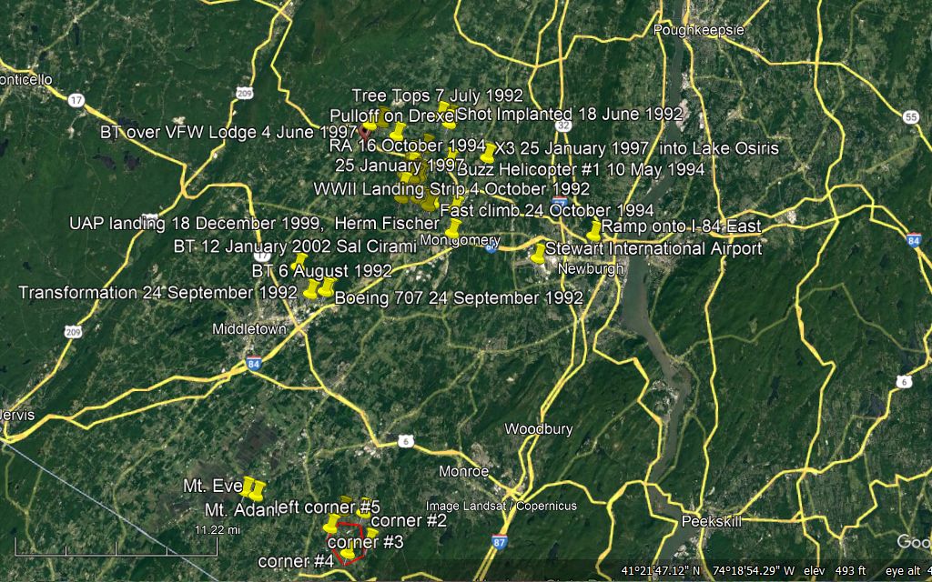
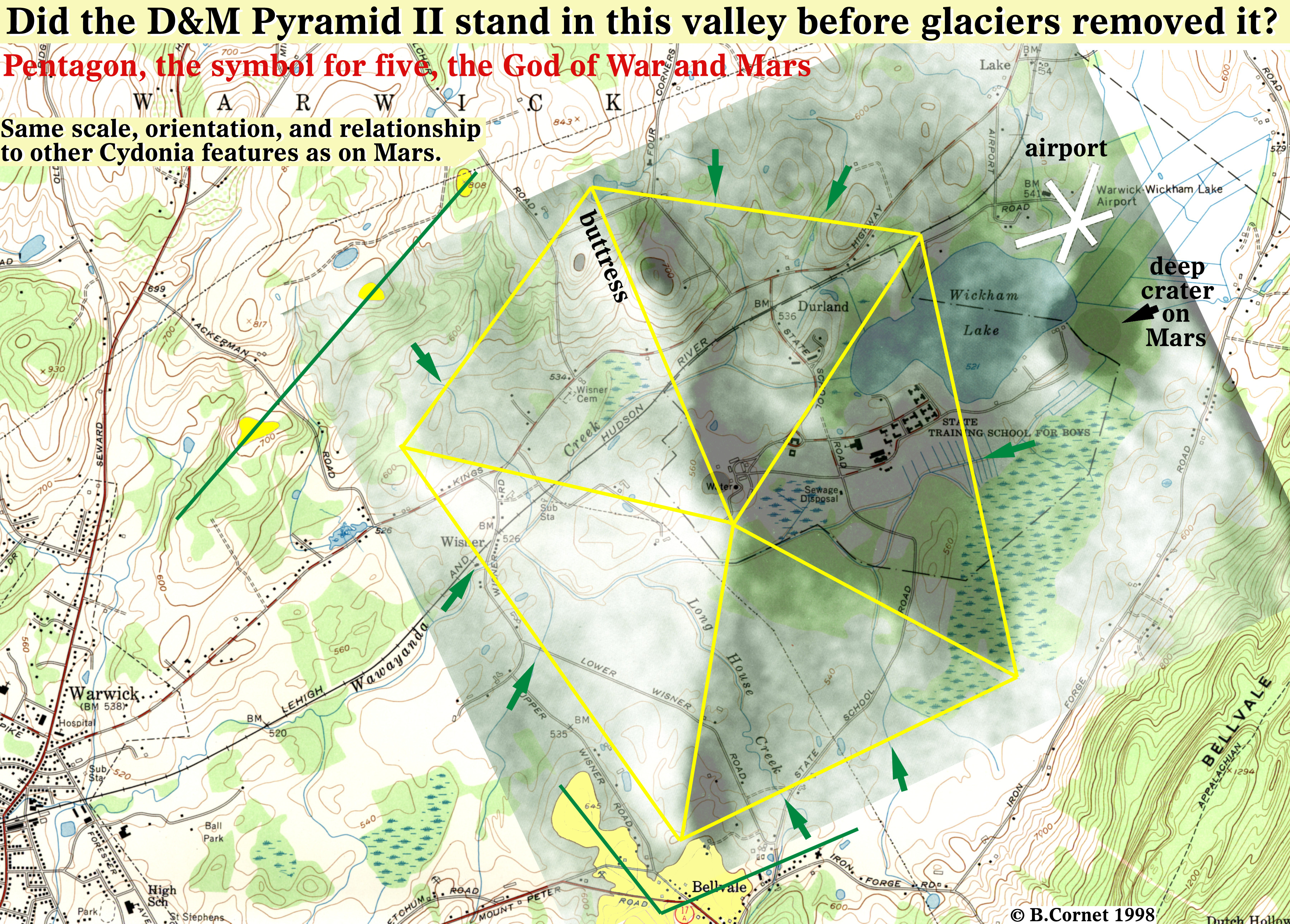
At the bottom of the above map are the five yellow pins marking the five corners of the giant D&M Pyramid base outline near Warwick, NY, which was duplicated on Mars 118,500 years ago based on Continental Drift on Earth. See the Cydonia II Report on my B.U.F.O.D. website:
www.bufod.co.uk/b_cornet/Vol_2/index.html
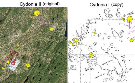
Cydonia I on Mars compared to Cydonia II on Earth. The centers of both craters at the same Latitude (41 degrees, 36 minutes). The pyramid was destroyed by the descending Wisconsin glaciers 60,000+ years ago. The ancient high-tech space-faring civilization that constructed the Cydonia monuments in the Wallkill River Valley knew that glaciers would destroy them, so they constructed a duplicate on Mars in the Cydonia region for historical preservation.
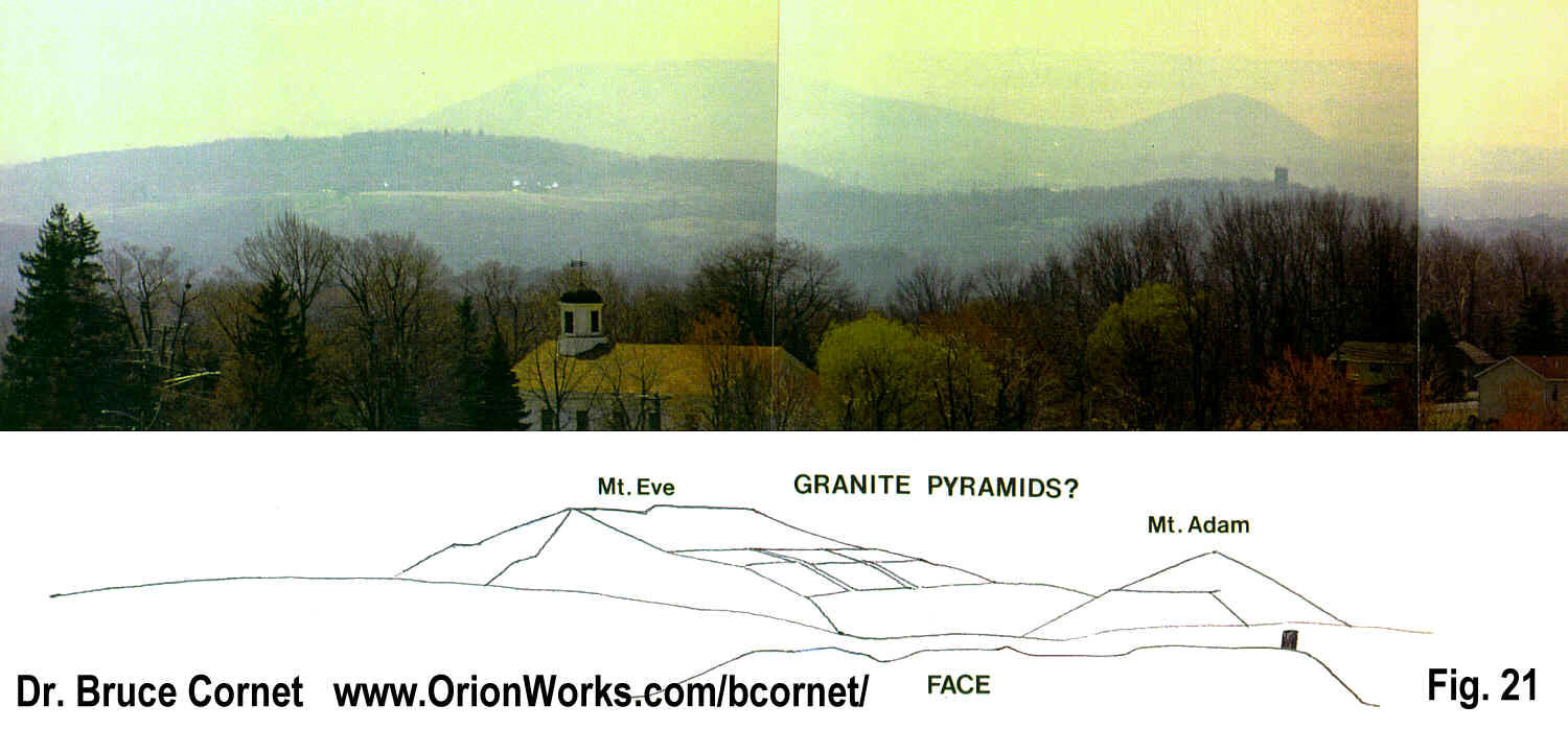
To the left of that pyramid base are two pins for Mount Adam and Mount Eve, named by the early European settlers in the valley. Mount Eve is in the shape of a KEY, while Mount Adam was a stepped pyramid carved out of bedrock. Remnant steps on the North side of that pyramid can still be seen.
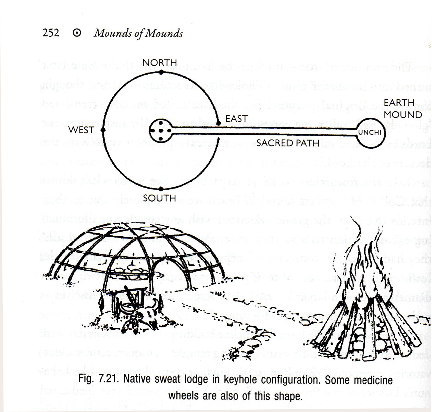
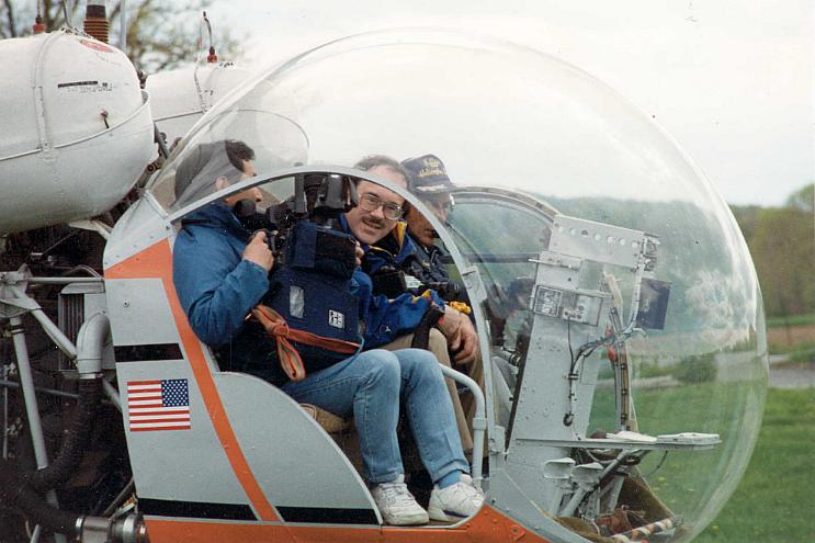
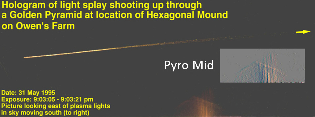
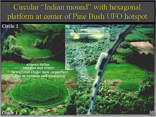
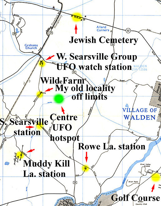
Ellen Crystall and Bruce Cornet frequented the Wilde Farm property at the dogleg bend in West Searsville Rd. in 1992 to 1994, and UAP showed up dozens of times to put on aerial performances at night, forming skyglyphs that Cornet captured on his time exposures. It was not until 10 May 1994 that Cornet had an opportunity to fly in a helicopter over this area with a Japanese camera crew. He discovered an ancient Indian Mound that marked the general entrance to an extensive underground alien base, where Native Americans (Lenni-Lenape Tribe) worshipped Spirit Lights entering and exiting before Europeans moved into and settled the Wallkill River Valley in the 1,600s. The two circular features in the landscape can be compared to a native sweat lodge outline in keyhole configuration (Martinez, The Lost History of the Little People, 2013). The unusual permanent crop circle defined by trees surrounding dairy farm field, and the raised eight-foot-high oval-hexagonal mound are large versions of a huge Sweat Lodge with Unch or Earth Mound upon which a pyramidal fire was built to heat rocks for the sweat lodge, now long collapsed and disappeared. Why were the Lenape people so interested in worshipping at that location over an active underground alien base? The answer to that question should be obvious.
So why has the News Media essentially ignored all the evidence presented above, which has been available online since 2000?
http://www.sunstar-solutions.com/AOP/SOW/aop_toc.htm
This web page was created on 24 August 2003.
It was last updated on
07/30/2023
© Bruce Cornet 2003